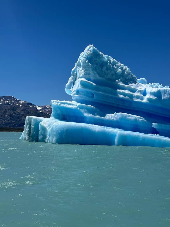
Rupture cycle
Perito Moreno
The glacier that dams a lake
Sail past these glaciersGuides
Language
Currency
Find a datestarts at $225 · cancel freeChoosing helper
Two questions, one way to meet the ice
Say how close you want to get and how much of the day you can give, and the matching trip appears with its starting price.
Best choice for you
from $225
8 to 12.5 hours: the Spegazzini Arm, the Upsala Channel and the north wall of the Perito Moreno, lunch on board.
Best choice for you
from $243
10 hours from the port to the Upsala and Spegazzini glaciers, with an optional lunch.
Best choice for you
from $370
11 hours, with 50 minutes at the Upsala Glacier and lunch at Estancia Cristina.
Best choice for you
from $399
A boat from Bajo de las Sombras across Brazo Rico and a walk on the Perito Moreno, 5 to 11 hours.
Best choice for you
from $69
8 hours with 3 hours at the glacier walkways and an optional 1-hour sailing.
What is the Perito Moreno Glacier, beyond a famous wall of ice? A river of ice flowing from a vast field in the Andes, and the key to the cruise. Here is how it moves, breaks and dams a lake, in official figures.
Editorial team, elcalafateglaciercruise.com · Updated November 9, 2026 · Read in 9 min
Quick look
What is the Perito Moreno Glacier? Put simply, it is a river of ice. Snow falls on the high Andes, piles up year after year, turns to ice under its own weight and flows slowly downhill toward Lago Argentino. The glacier's walkway map puts it plainly: the movement comes from the push of accumulating snow.6 What you see from the boat is the end of that journey, where the ice meets the water and breaks away.
The Perito Moreno is not alone. Parques Nacionales lists the Upsala, Spegazzini, Seco and Onelli among the glaciers of the park's southern zone,7 and ice covers almost half of Los Glaciares National Park.8 The Perito Moreno and the Upsala are among the glaciers that drain into the arms of Lago Argentino.9 A single cruise can show you several of them in a day, each at a different stage of the same process, from steep hanging ice to broad outlets of the field.
Parques Nacionales spells out where its fame comes from: easy access, striking beauty and a singular natural event, the periodic rupture of its front.10 The road and walkways bring visitors to within sight of the ice, and the boats bring them to its foot. Understanding how the glacier works turns the cruise from a sequence of pretty views into a story you can follow, and helps you know where to look at each stop.
The ice in figures
| Feature | Figure | Source date |
|---|---|---|
| Ice field area | 12,500 sq km1 | Park leaflet |
| Ice field length | 370 km15 | Park leaflet |
| Perito Moreno area | 254 km23 | Park leaflet |
| Perito Moreno length | Close to 30 km4 | Park web page |
| Perito Moreno front | 4 to 5 km4 | Park web page |
| Lake and glacier level | 177 m above sea20 | Park leaflet |
Figures from Parques Nacionales; its 2016 news note gives the glacier as 60 m high.21
Every glacier on the cruise starts in the same place. The Southern Patagonian Ice Field covers 12,500 square kilometers shared by Argentina and Chile and is the starting point for many of the park's glaciers.1 The park leaflet gives it a length of 370 km, with 48 major glaciers and more than 100 minor ones,15 and ranks it the third-largest ice field on Earth after Antarctica and Greenland.2
Not every glacier in the park is fed by that field. The leaflet describes peripheral glaciers, which are not connected to it and grow from snow piling up on mountain tops.16 From the deck you can often tell glaciers apart by shape: the field's outlet glaciers pour down valleys as broad tongues of ice reaching the water, while smaller hanging glaciers cling to the slopes above it, often ending in cliffs well above the lake.
This field is a remnant. The park's leaflet calls today's ice sheets and glaciers the remains of past ice ages,17 and says the largest ice-sheet expansion, 1 million years ago, covered southern Santa Cruz from the Andes to the Atlantic.18 The flat steppe you cross on the way to the port was once under ice too. Every glance west from the deck takes in what remains of that ice, still draining into the water under your boat.
Comparisons make the size of the Perito Moreno Glacier easier to picture. The park leaflet puts its area at 254 km2, a bit larger than Buenos Aires City at 203 km2.3 From its source to the lake it runs for close to 30 km, ending in a front 4 to 5 km wide on the lake's south arm.4 From the boat you see only the very end of that length, and still the wall seems to run on in both directions. Pick out a detail on the face, such as a dark band of rock or a deep crack, to give your eye a sense of scale.
Its height above the water depends on the source you read. A 2016 Parques Nacionales note gives the glacier as 60 m high, 5 km wide and 30 km long,21 while the park's 2024 leaflet compares the snout to the Obelisk of Buenos Aires, which stands 67.5 m tall.26 Both describe a face the height of a large apartment block, rising straight out of the lake at only 177 m above sea level.20 It is the same water level that laps the shore below El Calafate, on the far side of the same lake.
Big as it is, the Perito Moreno is not the largest glacier in the park. The leaflet gives the Viedma Glacier 975 km2, the largest in Argentina and the second largest in South America.19 The cruise does not reach the Viedma, which lies further north, but the comparison helps when you see the Upsala and Spegazzini: the glaciers on this lake vary hugely in size and shape, and each fills its valley differently.
Glaciers on the route
Rupture cycle
The glacier that dams a lake
Sail past these glaciers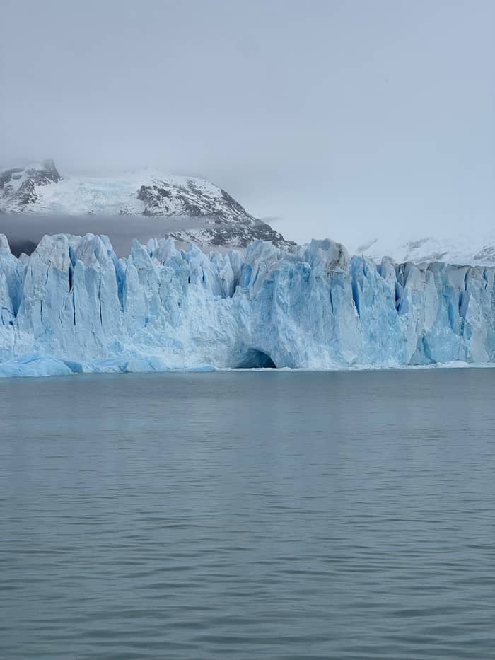
Steep valley
Steep and tall
Sail past these glaciers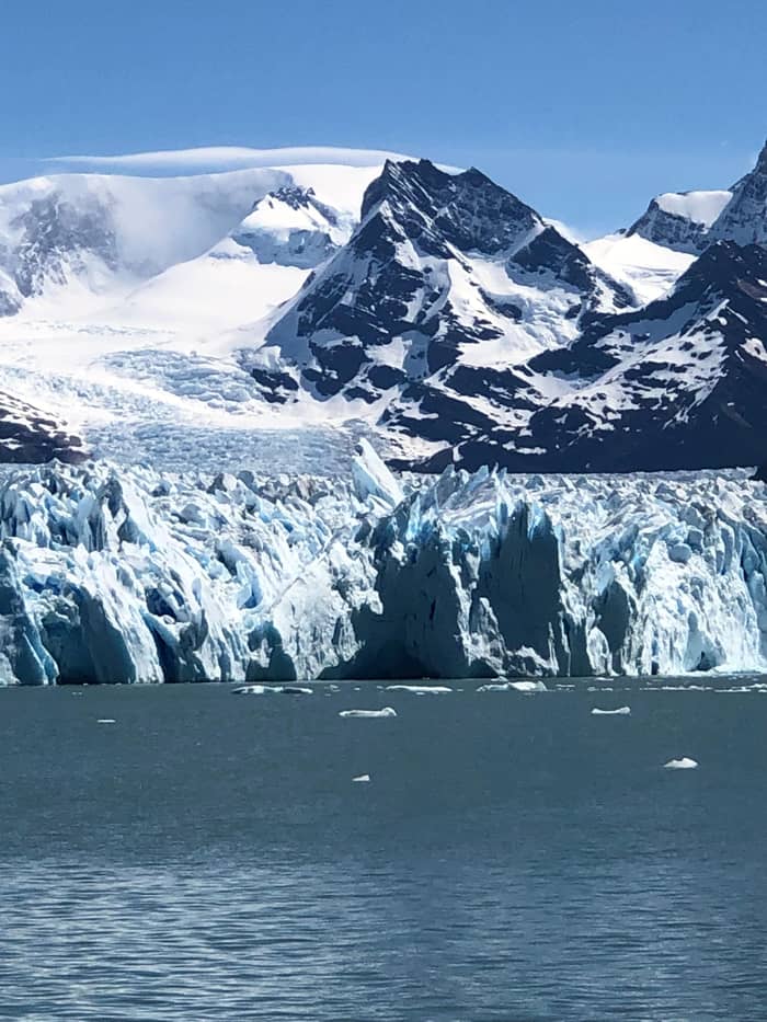
Seen from afar
An outlet of the ice field
Glaciers never stand still. Parques Nacionales describes how, in their slow movements, these frozen rivers keep forming new shapes that advance and retreat.27 At the front, where the ice reaches the lake, the pressure from behind meets open water, and blocks of ice break away and crash down. The park says these falls are as striking as the sight of the glaciers themselves.25 Some visits bring several falls in a short time; at other times the face stays silent for long stretches, and patience pays.
From the boat, calving happens in stages. First you hear a crack like a rifle shot, sometimes long before you see any movement. Then a slab leans out from the face, and a moment later it drops into the lake with a roar and a surge of water. Keep watching the spot after the splash: smaller pieces often follow, and the wave can rock the floating ice in the channel for minutes afterwards. Filming beats photographing here: hit record at the first crack.
Distance rules follow from that force. The walkway rules ban climbing over the railings, since splinters from a calving block can fly dozens of meters.28 Out on the lake, the cruise listing rules out any close approach to the Upsala and Bertacchi. Trust the captain's choice of distance and watch any collapse from the deck, with a camera ready and a hand on the rail. The view is just as dramatic from a safe distance.
A rupture, step by step
Advance
The glacier touches the Magallanes Peninsula.5
Dam
Water can no longer flow to the main lake.5
Filtration
Water seeps through a small channel under the ice.11
Flow
It passes from Brazo Rico into the iceberg channel.12
Arch
Pressure cracks the ice into an arch.13
Collapse
In 2016 the bridge broke on 10 March.14
The Perito Moreno's most famous trick happens at the Magallanes Peninsula. As Parques Nacionales tells it, once the glacier's advance carries it onto the peninsula, water can no longer pass between Brazo Rico and the main lake.5 The glacier becomes a dam. Water builds up behind it on the Brazo Rico side, and the pressure on the ice grows month by month. The ice-front panel of the map on our route page shows how slim the gap between glacier and shore is.
Then the water fights back. In its account of that event, the park describes water first filtering through a small channel under the glacier, which widens as the tunnel walls and floating ice at its base melt.11 The water then starts to pass from Brazo Rico into the Canal de los Tempanos,12 and the pressure cracks the glacier until an arch forms that finally collapses.13 For a while the water rushes beneath an ice bridge, a process that draws thousands of visitors to the walkways.29
Its news pages followed such a cycle over a few days in March 2016, as rangers kept watch.29 On 8 March rangers spotted a filtration in the front of the glacier, the start of the process,29 and on 10 March 2016 the ice bridge broke completely, watched by hundreds of tourists and residents.14 The walkway map is honest about timing: the rupture is impossible to predict.30 If one is under way during your trip, check the park's news pages and ask at the information center in town.
Video
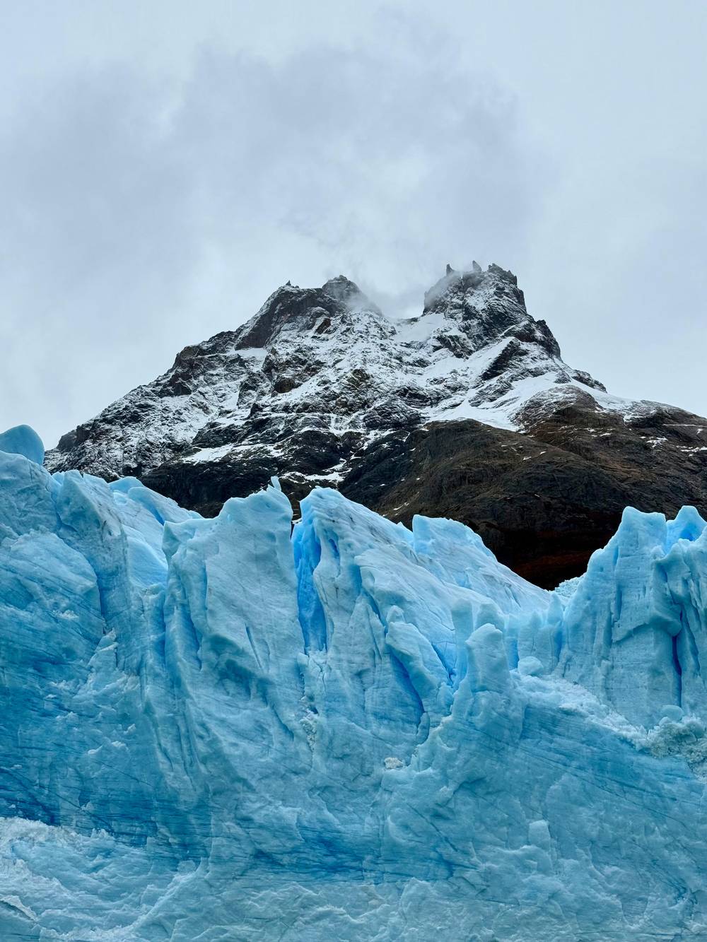
DW Documentary on YouTube · The video waits until you tap play to load.
The Southern Patagonian Ice field is the third-largest ice Field in our planet after Antarctica and Greenland.
On deck
Is the Perito Moreno Glacier melting? The park's own pages answer with movement rather than a melt figure. In its March 2016 note, Parques Nacionales describes the glacier as being in slow and continuous advance toward land, the feature that lets it dam the water between the north and south arms of the lake.31 Ice keeps arriving at the front even as blocks fall away from it, a reminder that every glacier front is where ice arriving meets ice leaving.
That is different from saying nothing changes. Every glacier both gains ice from snow and loses it to melt and calving, and the balance between gain and loss decides whether its front advances or retreats. The park's leaflet reminds visitors that all of today's glaciers are the remains of past ice ages,17 and that when glaciers retreat, the hollows they carved fill with meltwater and become large glacial lakes.32
For a precise, up-to-date answer about any single glacier, ask the guides on board or the park's information center in El Calafate, on 02902-492504.33 What you can see for yourself from the deck is the evidence of movement: fresh blue scars where blocks have fallen, crevasses opening at the front, and floating ice drifting away from the face toward the open lake. Each of those is part of the glacier's daily life.
Glaciers are more than scenery. The park's leaflet explains that they help cool the planet by reflecting between 45 and 85 per cent of the sunlight that reaches them.34 They also store fresh water, which is scarce: only 3% of all the water on the planet is fresh.35 The ice you sail past today is part of that store, slowly released into the lake below. Seeing it up close makes those figures easier to remember.
The colors on the cruise tell the same story. Dense, old glacier ice absorbs the red part of daylight and lets the blue through: the deepest cracks and newly exposed faces glow blue while the weathered surface looks white. The milky turquoise of the lake comes from fine rock flour ground by the ice and carried in by meltwater, which hangs in the water and scatters the light. On a bright day the contrast between blue ice and turquoise water is at its strongest.
Knowing this changes how you watch the day. The Spegazzini, rated by the park as its tallest glacier,22 shows how a glacier squeezed into a steep valley can tower over the water. The wide view of the Upsala shows the scale of an outlet of the ice field. The Perito Moreno, at the end of the route, shows the whole cycle in action: advance, dam, calving and, now and then, rupture. On a clear day you can follow all of it from the deck.
FAQ
The park leaflet gives the Viedma 975 km2, the largest in Argentina.19
The park's walkway map calls the rupture impossible to predict.30
Only the Antarctic and Greenland ice sheets are larger.2
Sources
More to read
Which glacier boat, and is the full day worth it? A real person answers.