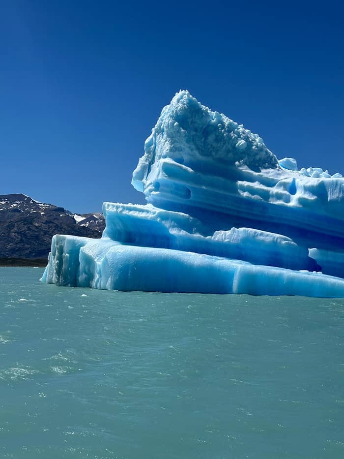
Closest face
Spegazzini Arm
Hanging glaciers and a landing
- GlaciersSeco, Heim, Spegazzini
- LandingPuesto Las Vacas
- Look forIce on both shores
Guides
Language
Currency
Find a datestarts at $225 · cancel freeLook up your stop
Open 21 stops
Pick a route, then tap a marker or a stop for notes and a Google Maps link.
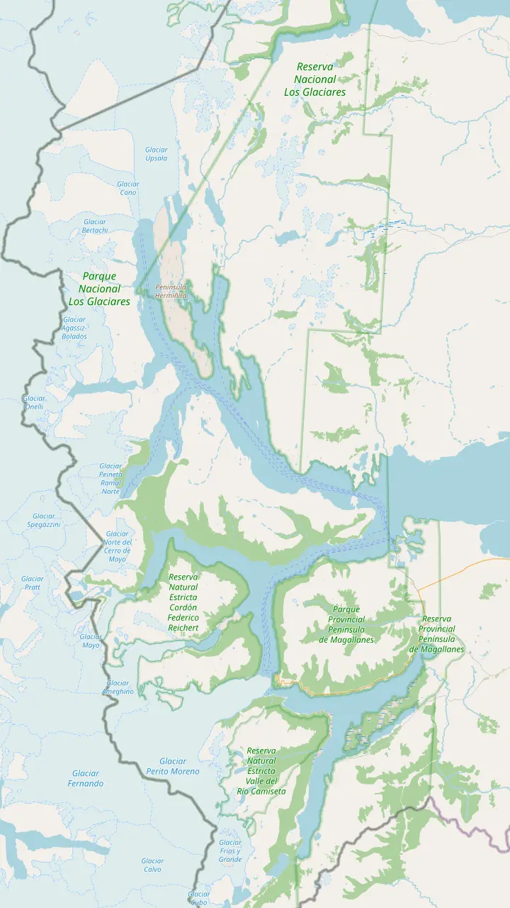
The cruise operator's private port at Punta Bandera, where the gourmet cruise boards; parking is free but unguarded.
Google MapsThe long northern arm the cruise enters after leaving the port.
Google MapsThe arm that leads to the Seco, Heim and Spegazzini glaciers.
Google MapsLanding point for a walk ashore, in a corner of the park reached only by water.
Google MapsA hanging glacier on the way into the Spegazzini Arm.
Google MapsSeen from the deck in the Spegazzini Arm.
Google MapsThe face the cruise stops in front of at the end of the Spegazzini Arm.
Google MapsSeen in panorama from the Upsala Channel, together with the Bertacchi; no close approach.
Google MapsA bay off the Upsala side named after the Onelli Glacier.
Google MapsA historic ranch on the Upsala Arm, visited by a different boat trip.
Google MapsA side arm west of the iceberg channel, sailed by other boats.
Google MapsThe iceberg channel the cruise follows to the glacier's north wall.
Google MapsClose to 30 km long, with a front of 4 to 5 km on the lake.
Google Maps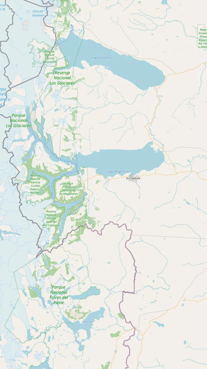
The town at the east end of the lake, where cruise transfers start their round of hotel pickups.
Google MapsComandante Armando Tola airport, almost 23 km from the town centre.
Google MapsLong-distance buses arrive here; the town centre is a short walk or taxi ride away.
Google MapsPunta Bandera is 47 km from El Calafate on the paved RP 11 and RP 8.
Google MapsThe cruise operator's private port at Punta Bandera, where the gourmet cruise boards; parking is free but unguarded.
Google MapsRio Mitre portal on the walkway road, 50 km from El Calafate on RP 11.
Google MapsMore than 4.5 km of walkways and balconies facing the ice front.
Google MapsClose to 30 km long, with a front of 4 to 5 km on the lake.
Google Maps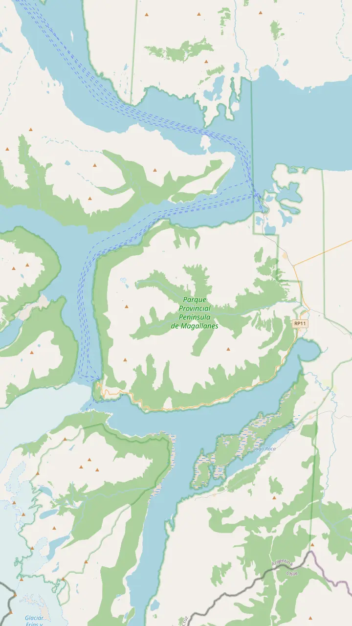
Close to 30 km long, with a front of 4 to 5 km on the lake.
Google MapsMore than 4.5 km of walkways and balconies facing the ice front.
Google MapsThe iceberg channel the cruise follows to the glacier's north wall.
Google MapsThe peninsula the advancing ice reaches, splitting Brazo Rico from the main lake.
Google MapsThe southern arm that the ice cuts off from the rest of the lake when it touches the peninsula.
Google MapsA side arm west of the iceberg channel, sailed by other boats.
Google MapsRio Mitre portal on the walkway road, 50 km from El Calafate on RP 11.
Google MapsMap source: © OpenStreetMap contributors
Where is the Perito Moreno Glacier, and what lies between it and the port? Follow the full-day cruise arm by arm, from Punta Bandera past the Spegazzini and Upsala glaciers to the north wall of the ice.
Editorial team, elcalafateglaciercruise.com · Updated November 9, 2026 · Read in 9 min
Quick look
Where is the Perito Moreno Glacier, exactly? It lies inside Los Glaciares National Park in the province of Santa Cruz, in Argentine Patagonia, and its front of 4 to 5 km meets the south arm of Lago Argentino.1 Created in 1937, the park joined UNESCO's World Heritage list in 1981,6 and at 726,927 hectares it is the largest of the country's national parks.7,8 Almost half of it lies under ice.9
The ice does not start where you see it. The Southern Patagonian Ice Field, a sheet of 12,500 square kilometers that Argentina shares with Chile, feeds many of the park's glaciers,10 and the Perito Moreno is a tongue of that field flowing down toward the lake. What surprises many people is how low it sits: the park's leaflet puts both the lake and the glacier only 177 m above sea level.11
That low, sheltered position is why a boat can reach so much ice in a single day. Instead of climbing to the glaciers, you sail to their feet along hollows the ice itself carved and then left full of meltwater.12 El Calafate stands on the southern shore near the lake's eastern end, and the cruise sails the same body of water that lies in front of the town, even if the glaciers stay hidden behind the mountains until you are well underway.
On the route
| Place | Lake arm | What the cruise does | Official note |
|---|---|---|---|
| Seco and Heim | Spegazzini Arm | Passes on the way in | Named on the route3 |
| Spegazzini | Spegazzini Arm | Sails to the glacier | Tallest in the park19 |
| Puesto Las Vacas | Spegazzini Arm | Lands for a walk | Reached only by water14 |
| Upsala and Bertacchi | Upsala Channel | Panoramic view | No close approach |
| Perito Moreno | Canal de los Tempanos | Sails to the north wall | Close to 30 km long1 |
Order and names as Parques Nacionales and the listing give them; the boat's exact course depends on ice and wind on the day.3,5
Lago Argentino is the key to the map. Parques Nacionales describes it as the lake with the largest surface area in Patagonia, and the Perito Moreno and Upsala glaciers are among those that drain into its arms.15,16 Seen from above, it looks less like a lake than a hand: a broad body to the east and long, narrow fingers reaching west into the Andes, each ending at a wall of ice. The cruise spends its day inside those fingers, far from the open water near town.
Boats work both the North Arm and the South Arm of this branching lake,17 and some of these trips are the only way into the heart of the national park.18 For a day visitor, the western arms are boat country. If you want to see them, a Perito Moreno Glacier boat tour on Lago Argentino that also sails the northern arms is the practical answer, and the cruise this site books does exactly that.
Our map splits the lake into the pieces you will actually sail. The route panel follows the full day from the port through the North Arm and the Spegazzini Arm, up the Upsala Channel and back south. The port panel shows the roads from the airport and town. The last panel zooms in on the Perito Moreno front, the Canal de los Tempanos and Brazo Rico, the corner of the lake where the famous ice dam forms.
The route in order
Boarding
Meeting time 8:30 AM at the port.
First leg
Toward the Seco, Heim and Spegazzini glaciers.3
Landing
Lunch leg
Panorama of the Upsala and Bertacchi glaciers.4
Last leg
South to the glacier's north wall.5
Your choice
Get off at the walkways or sail back to La Soledad.
Your sailing day begins on the shore at Punta Bandera, reached by 47 km of paved road from El Calafate, RP 11 and then RP 8.2 The gourmet cruise boards at La Soledad, the operator's own private port there, from which all of its trips into the park depart,22 and the listing sets the meeting time at 8:30 AM. If you booked the pickup, the transfer brings you there; if you drive, allow time for the park fee at the gate. Parking at the port has no security service: leave nothing valuable in the car.23
Once the lines are cast off, the boat turns into the North Arm and heads for the Seco, Heim and Spegazzini glaciers.3 Escuadra Bay and a cliff where condors nest are also among the sights the listing names for this stretch. Keep binoculars handy for that stretch: the Andean condor spans 3 meters from wingtip to wingtip and rides rising air for long distances without a single beat of its wings.24 Scan the cliffs above the waterline rather than the open sky.
This first leg is the quietest part of the day. The water is open and the mountains close in slowly on both sides. Use it to walk the decks, find a sheltered corner for the cold stretches, and work out where you want to stand when the first glacier appears. A spot near a door or stairway lets you step out quickly and step back in to warm up between views, and a seat by a window saves your place for lunch.
Plan your route
Match what you most want to see with the route that reaches it.
If A glacier face up close from the boat
The Spegazzini Arm
The route reaches the glacier Parques Nacionales calls the park's tallest.19
If Solid ground in the middle of the day
Puesto de Las Vacas
The gourmet route lands there for a walk ashore.13
If A long look at the Upsala Glacier
Consider the Estancia Cristina trip
Its boat heads up the Upsala Arm with the glacier in view.20
If The Perito Moreno as well
Stay for the last leg
The cruise follows the iceberg channel to the north wall.5
If The south face of the Perito Moreno
A boat from the walkways
Other boats leave from the walkway sector in front of the glacier.21
Stretch by stretch
Closest face
Hanging glaciers and a landing
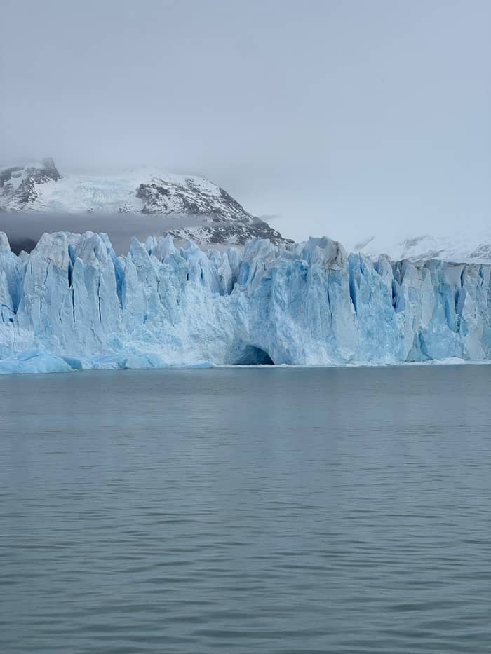
Widest view
Icebergs and a wide panorama
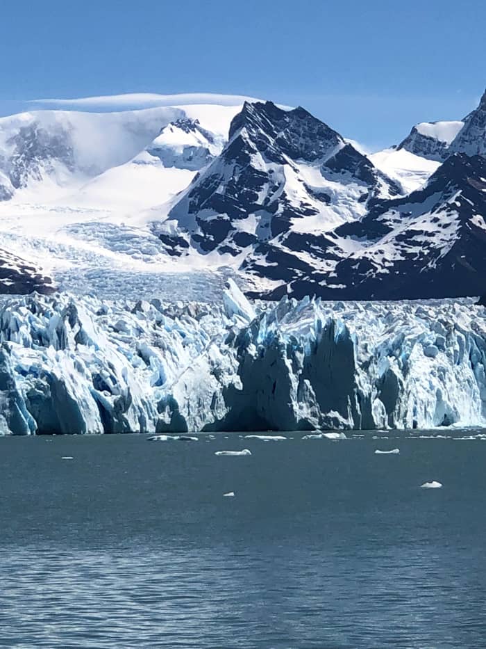
Famous wall
South to the famous wall
The Spegazzini Arm is where the ice starts in earnest. The Seco and Heim glaciers hang above the water on the way in,3 and the arm ends at the Spegazzini, in the park authority's words the tallest of its glaciers and one of the most spectacular.19 When the face comes into view, watch how the light changes the color of the ice and listen for the cracks that carry across still water.
Then comes the walk ashore. The boat ties up at Puesto de Las Vacas so you can walk on land,13 a remote corner of the national park that can be reached only by water.14 The listing calls it a short walk, a chance to stretch your legs on solid ground and see the forest and the outpost up close rather than a hike. Sturdy shoes that can handle wet grass and stones are worth wearing.
On the map, Puesto Las Vacas sits near the mouth of the Spegazzini Arm. If the weather is clear, look back across the water from the landing: the line of ice along the far shore shows how many small glaciers feed this single arm, and gives you a sense of the scale that is hard to grasp from the deck. It is also a good moment for photographs with people in them: the ground is still and the light is often softer on land than on the glare of open water.
Compare routes
Ways to sail the northern arms, priced for your group.
Side-by-side: 3 options
Ways to sail the northern arms, priced for your group.
≈
View≈
View≈
ViewThese from-prices come from GetYourGuide and are converted using the ECB reference rate; the exact price shows at checkout.
From the Spegazzini Arm the route swings north into the Upsala Channel, where the Upsala and Bertacchi glaciers appear as a wide panorama and lunch comes to the table for those who added it.4 The listing is plain about a point that some guests only learn on the day: boats may not go close to these glaciers. Expect a wide view across the water, not a face looming over the bow.
That distance is worth accepting for what you see on the way. Watch the water as well as the horizon: any floating ice in the channel has broken away from the glaciers at its head, and it comes in shades from chalk white to deep blue. Have the camera ready before the channel narrows. The northern shore of the Upsala Arm is also where Estancia Cristina stands, a ranch reached by a separate boat trip that sails the arm with views of the glacier.20
If the Upsala Glacier is the reason you came, compare the options before you book. The full-day gourmet cruise shows it as a view among many, from the water. The Estancia Cristina trip spends its day on the Upsala side of the lake, and the decision helper on this page sets out which route suits which wish. Either way, plan on a clear, calm day if you can: the wide views of the Upsala side are the ones low cloud spoils first.
Video
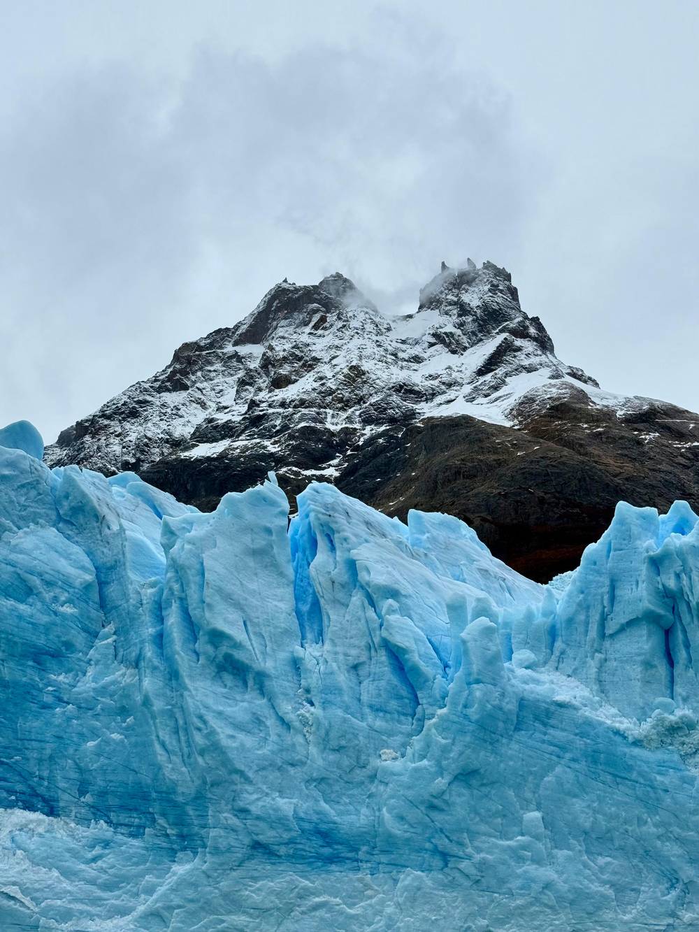
Samuel and Audrey on YouTube · The video waits until you tap play to load.
Some of these options are the only way into the heart of the National Park.
The last leg turns south. The cruise sails the Canal de los Tempanos, the iceberg channel, toward the north wall of the Perito Moreno Glacier.5 After the wide northern arms, this channel feels narrow and busy with floating ice. This is the face that hikers on the walkways look at from the other side of the water, and from the boat you see it from below, with the ice running back into the mountains for close to 30 km.1
This corner of the map explains the glacier's fame. Each time the ice pushes far enough to reach the Magallanes Peninsula, Brazo Rico is sealed off from the rest of Lago Argentino,28 and the water trapped behind the dam eventually breaks through. Our page on how the glaciers work tells that story in full. Open the ice-front panel of the map and you will find the peninsula and Brazo Rico south and east of the channel you sail.
Here the listing offers a choice: you can get off at the Perito Moreno footbridges instead of sailing back. Over 4.5 km of walkways wind through the forest there, ending at balconies that face the ice,27 and other boats leave from that same sector.21 Staying on board means a sail back to La Soledad; getting off means an afternoon on the walkways and the trip back to town by road. Decide before the day and pick the matching option when you book.
A few distances help you plan the day around the route. The airport sits almost 23 km from the center of El Calafate,25 the port is 47 km away by road,2 and the Rio Mitre gate on the road to the walkways is 50 km out.26 If you want a Perito Moreno Glacier boat tour in Patagonia that covers both the northern arms and the famous face, the port route shown here is the one to choose. Boats that leave from the walkway sector are the other way to see the famous face.21
Weather shapes how the map feels on the day. The same route can be all bright ice and turquoise water, or gray channels and glaciers half hidden in cloud. The landmarks do not move, though, and knowing them helps: if the Upsala view is hazy, the Spegazzini face and the Perito Moreno wall still arrive close enough to impress. Bring layers for the long open-water stretches between the arms.
The full-day gourmet cruise booked on this site starts from $225 with 8 to 12.5 hours as the duration on its listing. Use the price comparison on this page to weigh it against cruises that sail different parts of the lake, then check the departure date, the pickup option and the lunch choice on the booking page before you confirm. With cancellation free until 24 hours ahead, you can keep an eye on the forecast before you commit.
FAQ
The cruise shows the Upsala and Bertacchi glaciers in panorama from the Upsala Channel.4
The last leg follows the Canal de los Tempanos, with an option to get off at the footbridges.5
Sources
More to read
Which glacier boat, and is the full day worth it? A real person answers.